
Professional Drone Services in
Windsor
Aerial mapping, inspections, thermal imaging, and 3D scanning for automotive, manufacturing, and commercial projects across Essex County.
Get a Free QuoteYour Windsor
Drone Partner
Essex County Coverage
Serving Windsor and Essex County's automotive plants, manufacturing facilities, greenhouses, and commercial properties throughout Southwestern Ontario's border region.
Efficient Scheduling
We serve Windsor and Essex County with scheduled projects. For larger mapping campaigns or recurring contracts, we coordinate efficient scheduling to serve your needs.
Fully Certified
Transport Canada Advanced Operations authorization and $6.25M liability coverage. We carry the credentials Windsor's industrial operators and general contractors require.
Serving Canada's Automotive Capital
Windsor sits at the heart of Canada's automotive manufacturing corridor and near the US border. From the industrial facilities along the Detroit River waterfront to the greenhouse operations across Essex County, we serve the sectors that define Southwestern Ontario's economy.
The Ambassador Bridge corridor, Highway 401, and EC Row Expressway connect Windsor's major industrial areas we regularly survey for construction projects, facility documentation, and site documentation.
Advanced Operations Authorization
We hold Transport Canada Advanced Operations authorization and coordinate with Nav Canada when working near Windsor International Airport (YQG), which sits south of the city center.
Our familiarity with Essex County's airspace and proximity to the US border means we know how to navigate the regulatory requirements. We handle coordination with authorities so your project moves forward smoothly.
Recent Projects in
Windsor-Essex
We've supported engineering and infrastructure projects across the region, providing aerial mapping and LiDAR data collection for design and construction teams.

Transit Facility Expansion – South Windsor
Drone mapping for a transit facility expansion project near Windsor Airport. This site required NAV Canada airspace authorization due to its proximity to YQG, which we coordinated in advance to avoid project delays.

New Build Survey – Walkerville
Aerial survey for a new build project in the Walkerville area, providing baseline topographic data for the design team. Centimeter-level accuracy achieved using RTK positioning and ground control points.

New Facility Development – Essex County
Mapping for a new recreational facility just outside Essex, providing the baseline data the engineering team needed for site design.

Sugar Beet Stockpile Inspection – Chatham-Kent
Thermal imaging survey for a sugar beet storage facility north of Chatham. Using infrared, we identified hot spots indicating decomposition within the stockpiles, allowing the facility to address problem areas before rot spread.
All Windsor projects completed in partnership with regional engineering contractors, with Holland Productions supporting flight operations, data collection, and processing.
Drone Solutions for
Windsor Industries
From automotive manufacturing to greenhouse agriculture, we serve the industries that define Essex County.
Automotive & Manufacturing
Roof condition documentation, building envelope thermal scans, and facility documentation for automotive plants and manufacturing facilities. Supporting maintenance planning across Windsor's industrial sector.
Construction & Development
Progress monitoring for residential subdivisions and commercial developments. Orthomosaic mapping for site documentation. Volumetric measurements for earthwork and material tracking.
Greenhouse & Agriculture
Thermal imaging and facility documentation for greenhouse operations. Crop monitoring and field mapping for agricultural operations across Essex County's productive farmland.
Commercial Properties
Aerial documentation and inspections for commercial properties. Roof documentation, facade inspections, and site documentation for property management teams.
Drone Services for
Windsor
Comprehensive aerial solutions for every industry and application.
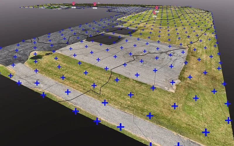
Aerial Mapping & Surveying
High-precision orthomosaics, topographic data, and volumetric measurements.
Learn More →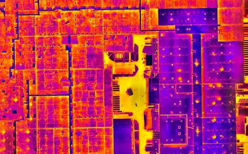
Thermal & Infrared
Certified thermography for roof moisture detection and building envelope documentation.
Learn More →
3D Scanning & Models
Photogrammetry, LiDAR, and digital twins for property documentation.
Learn More →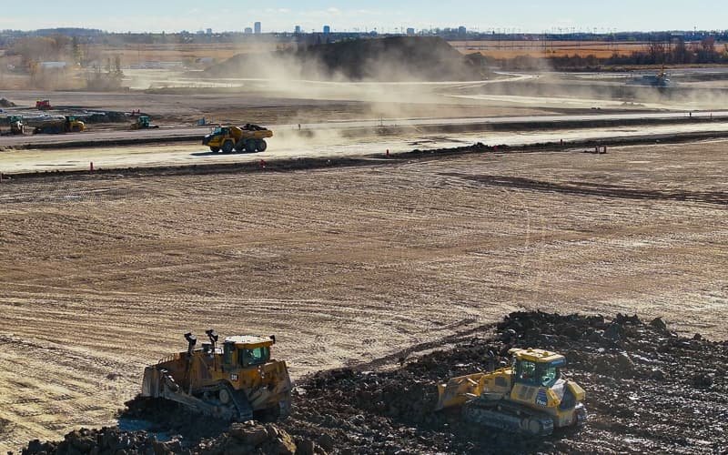
Construction Monitoring
Regular progress documentation and site surveys for development projects.
Learn More →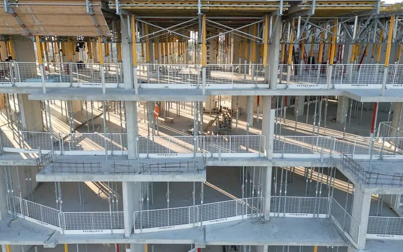
Drone Inspections
Safe, efficient inspections of roofs and facilities without scaffolding.
Learn More →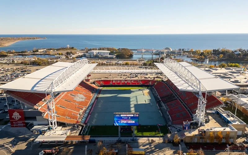
Aerial Photo & Video
Professional visuals for real estate, marketing, and project documentation.
Learn More →Southwestern Ontario Coverage
Leamington • Tecumseh • LaSalle • Amherstburg • Kingsville • Chatham-Kent
Drone Services in
Windsor FAQs
Do you fly in Windsor's industrial areas?
Yes, we regularly serve automotive plants, manufacturing facilities, and industrial properties throughout Windsor and Essex County. Our Advanced Operations certification allows us to work in complex environments including controlled airspace near Windsor Airport.
Can you operate near the waterfront?
Absolutely. We conduct surveys along the Detroit River waterfront and throughout Windsor's port and industrial waterfront areas, coordinating with relevant authorities as needed.
How quickly can you mobilize to Windsor?
We serve Windsor on a scheduled basis. For urgent projects or larger mapping campaigns, we coordinate efficient scheduling to meet your timeline. Contact us to discuss your specific needs.
What areas of Essex County do you cover?
We serve all of Essex County, including Leamington, Tecumseh, LaSalle, Amherstburg, Kingsville, Chatham-Kent, and the surrounding agricultural and greenhouse operations.
Let's Elevate Your
Windsor Project
Professional drone services across Essex County. Get your free quote today.
Get a Free Quote