
Professional Drone Services in
Ottawa
Aerial mapping, inspections, thermal imaging, and 3D scanning for government, construction, and commercial projects across the National Capital Region.
Get a Free QuoteYour Ottawa
Drone Partner
National Capital Coverage
Ottawa's complex airspace near the airport and Parliament Hill requires experienced operators. We hold a Transport Canada RPOC with Level 1 Complex certification and coordinate with Nav Canada for operations in controlled airspace.
Scheduled Projects
We serve Ottawa and the National Capital Region with scheduled projects. For larger mapping campaigns or recurring contracts, we coordinate efficient scheduling to serve your needs.
Fully Certified
Transport Canada RPOC with Level 1 Complex Operations certification and $6.25M liability coverage. We carry the credentials Ottawa's developers and general contractors require.
Drone Solutions for
Ottawa Industries
From government facilities to tech campus developments, we serve the industries that define Canada's capital.
Construction & Development
Progress monitoring for residential subdivisions and commercial developments. Orthomosaic mapping for site documentation. Volumetric measurements for earthwork and material tracking across Ottawa's growing suburbs.
Commercial & Institutional
Aerial documentation and inspections for commercial properties and institutional buildings. Roof documentation, facade inspections, and site documentation for property management teams.
Tech & Corporate Campuses
Facility documentation and inspections for Kanata's tech corridor and corporate campuses. Building envelope documentation, roof condition monitoring, and site planning support.
Solar Asset Owners
RGB and thermal inspection of rooftop and ground-mount solar arrays. Our imaging reveals underperforming panels, hot spots, and connection issues before they affect output.
Drone Services for
Ottawa
Comprehensive aerial solutions for every industry and application.
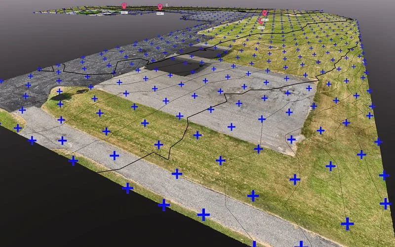
Aerial Mapping & Surveying
High-precision orthomosaics, topographic data, and volumetric measurements.
Learn More →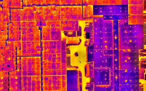
Thermal & Infrared
Certified thermography for roof moisture detection and building envelope documentation.
Learn More →
3D Scanning & Models
Photogrammetry, LiDAR, and digital twins for property documentation.
Learn More →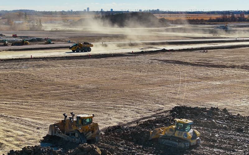
Construction Monitoring
Regular progress documentation and site surveys for development projects.
Learn More →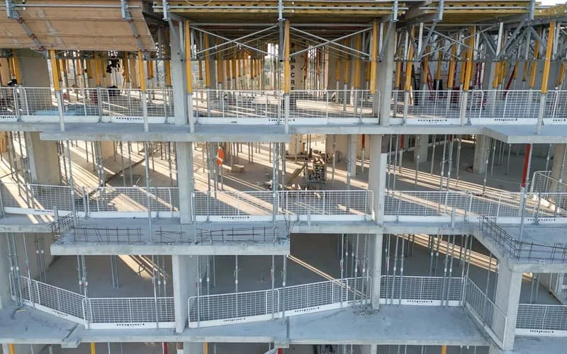
Drone Inspections
Safe, efficient inspections of roofs and facilities without scaffolding.
Learn More →
Aerial Photo & Video
Professional visuals for real estate, marketing, and project documentation.
Learn More →National Capital Region Coverage
Gatineau • Kanata • Orleans • Nepean • Barrhaven • Carleton Place
Let's Elevate Your
Ottawa Project
Professional drone services across the National Capital Region. Get your free quote today.
Get a Free Quote