
Professional Drone Services in
Guelph
Aerial mapping, inspections, thermal imaging, and 3D scanning for construction, agriculture, and commercial projects across Wellington County.
Get a Free QuoteYour Guelph
Drone Partner
Wellington County Coverage
Guelph sits at the heart of Wellington County, with a mix of urban development and agricultural land. We hold a Transport Canada RPOC with Level 1 Complex certification for operations across varied environments.
Efficient Scheduling
We serve Guelph and Wellington County with scheduled projects. Being within reasonable distance means we can coordinate site visits efficiently and plan around weather windows.
Fully Certified
Transport Canada RPOC with Level 1 Complex Operations certification and $6.25M liability coverage. We carry the credentials Guelph's developers and general contractors require.
Drone Solutions for
Guelph Industries
From University of Guelph research to agricultural operations and urban development, we serve the industries that define the region.
Construction & Development
Progress monitoring for residential subdivisions and commercial developments. Orthomosaic mapping for site documentation. Volumetric measurements for earthwork and material tracking.
Agriculture & Research
Crop health monitoring, drainage documentation, and field mapping for agricultural operations. Supporting research initiatives and precision agriculture across Wellington County's productive farmland.
Industrial & Manufacturing
Roof condition documentation, building envelope thermal scans, and facility documentation for manufacturing plants. Supporting maintenance planning and building condition documentation.
Commercial Properties
Aerial documentation and inspections for commercial properties. Roof documentation, facade inspections, and site documentation for property management teams.
Drone Services for
Guelph
Comprehensive aerial solutions for every industry and application.
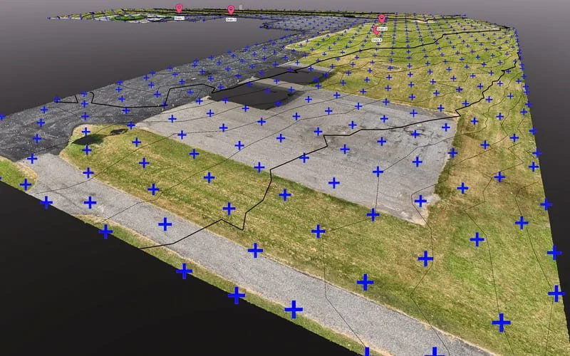
Aerial Mapping & Surveying
High-precision orthomosaics, topographic data, and volumetric measurements.
Learn More →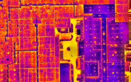
Thermal & Infrared
Certified thermography for roof moisture detection and building envelope documentation.
Learn More →
3D Scanning & Models
Photogrammetry, LiDAR, and digital twins for property documentation.
Learn More →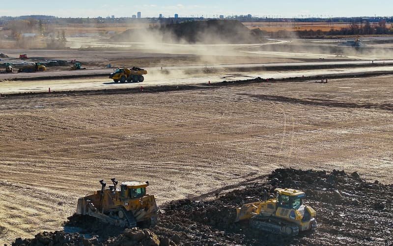
Construction Monitoring
Regular progress documentation and site surveys for development projects.
Learn More →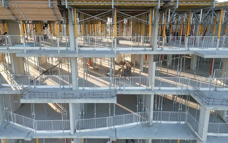
Drone Inspections
Safe, efficient inspections of roofs and facilities without scaffolding.
Learn More →
Aerial Photo & Video
Professional visuals for real estate, marketing, and project documentation.
Learn More →Let's Elevate Your
Guelph Project
Professional drone services across Wellington County. Get your free quote today.
Get a Free Quote