
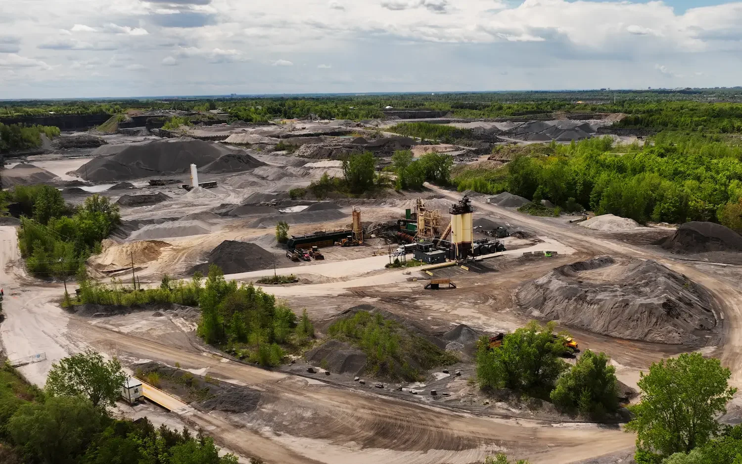
Drone Stockpile Measurements
Volumetric drone surveys using photogrammetry and LiDAR for accurate stockpile measurements. Inventory management, material tracking, and cut/fill analysis across Southern Ontario.
Request a Quote →*Results vary based on site conditions, ground control, and flight specifications
Know Your Inventory, Down to the Cubic Metre
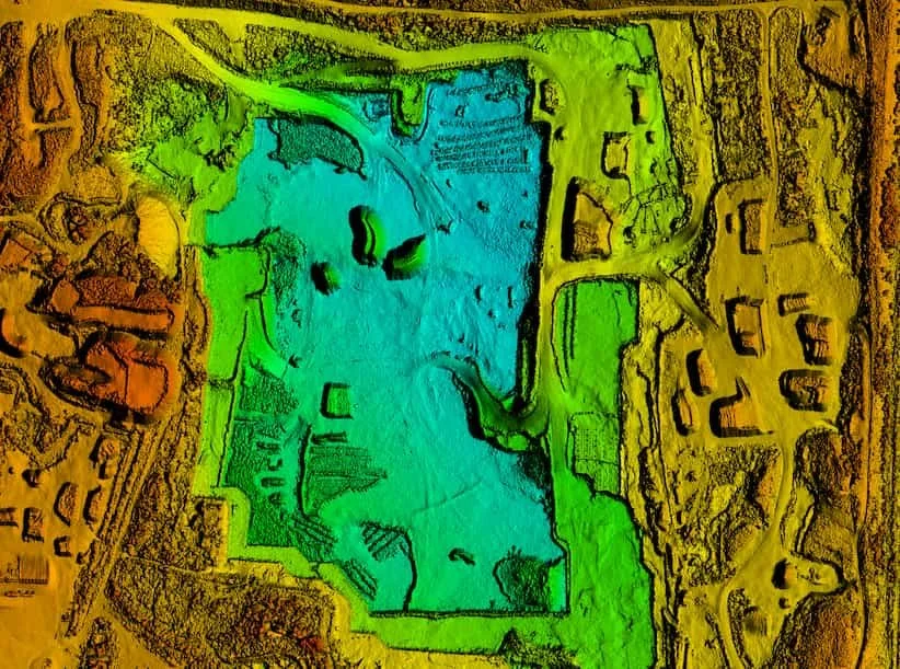
A drone stockpile measurement captures your entire site in hours, delivering precise volume calculations without interrupting operations or putting personnel on active stockpiles.
Whether you need a one-time inventory count or regular monitoring to track material movement, our photogrammetry workflow delivers centimetre-accurate data you can trust for billing, compliance, and resource planning.
Industries We Serve
Aggregates
Mining
Construction
Waste Management
Faster, Safer, More Accurate
Hours, Not Days
Complete aerial surveys in a fraction of the time required for traditional ground-based methods. Capture an entire site while operations continue below.
Enhanced Safety
No personnel climbing stockpiles or working in active material zones. All data captured from the air, eliminating fall risks and equipment conflicts.
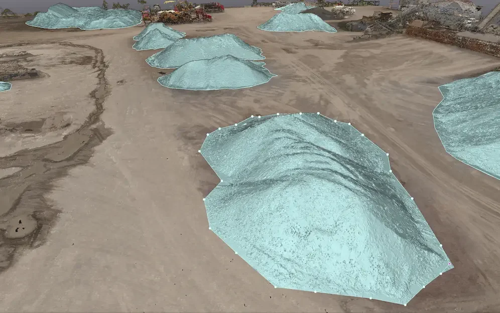
Centimetre-Level Accuracy
RTK-enabled flights and strategic ground control point placement deliver volume calculations with 1 to 3 percent accuracy between surveys.
Complete Coverage
Capture 100 percent of your site from above, including hard-to-reach areas, steep slopes, and active zones that would be dangerous to survey on foot.
Regular Monitoring
Schedule recurring flights to track inventory changes over time. Compare volumes month-over-month for material movement audits and progress tracking.
Minimal Disruption
Surveys conducted from the air mean your operations keep running. No equipment downtime, no blocked access roads, no production delays.
Data You Can Act On

Volume Reports
Detailed calculations for each stockpile with cut/fill analysis, tonnage estimates, and PDF summaries ready for stakeholders.
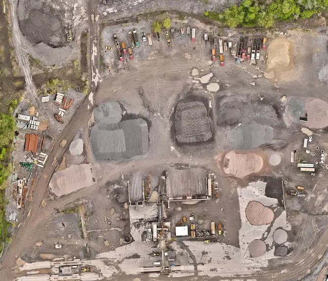
Orthomosaic Maps
High-resolution, georeferenced aerial maps of your entire site stitched from hundreds of overlapping images.
3D Models & Point Clouds
Dense point clouds and surface meshes for visualization, measurement, and integration with your CAD or GIS software.
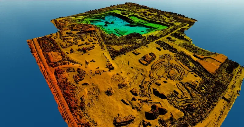
Elevation Models
Digital Surface Models (DSM) and Digital Terrain Models (DTM) showing elevation data across your site.

Comparison Reports
Track changes between surveys with side-by-side volume comparisons, material movement analysis, and trend reporting.

CAD & GIS Exports
DXF, DWG, LAS, LAZ, and other industry-standard formats aligned to your project coordinate system.
Our Survey Process
Consultation
Discuss your site, requirements, and accuracy needs.
Planning
Flight paths, GCP layout, and safety protocols.
Data Capture
RTK-enabled drone flights capture high-resolution imagery.
Processing
Photogrammetry software generates point clouds and volumes.
Delivery
Reports, models, and exports delivered to your team.
Common Questions
What is a drone stockpile measurement?
A drone stockpile measurement uses a drone equipped with photogrammetry or LiDAR sensors to capture high-resolution aerial data of stockpiles, earthworks, or cut/fill areas and calculate their volume accurately. This workflow is faster, safer, and more efficient than traditional ground-based methods.
Why do accurate stockpile volumes matter?
Material quantities impact inventory valuation, resource allocation, billing, and project costs. Mis-measured volumes can lead to budget overruns, inefficient workflows, disputes with suppliers or customers, and environmental compliance issues.
What industries benefit from drone stockpile measurement?
Construction, aggregates, mining, earthworks, site grading, materials yards, waste management, and any environment where bulk material volumes must be tracked reliably.
How accurate are drone volumetric measurements?
With proper ground control (GCPs or RTK) and execution, drone surveys typically achieve 1 to 3 percent volume accuracy between flights. Accuracy depends on site conditions, ground control placement, and flight specifications.
What deliverables do I receive?
Detailed volume reports with cut/fill analysis, georeferenced orthomosaics, 3D point clouds, digital elevation models, PDF summaries, and CAD/GIS exports (DXF, DWG, LAS, LAZ) aligned to your coordinate system.
Can you track changes over time?
Yes. We can capture data at regular intervals, compare new volumes against previous surveys, and report on changes. This is useful for stockpile depletion tracking, site progress monitoring, or material movement audits.
How long does a drone stockpile survey take?
Most sites can be surveyed in a few hours. Turnaround for processed deliverables is typically 1 to 2 business days, depending on site size and complexity.
How does this compare to traditional survey methods?
Drone-based volumetric surveys typically cost less, require less field time, reduce safety risk (no climbing stockpiles), and deliver richer data including point clouds and 3D models. Studies show comparable accuracy when best practices are followed.
Ready to Measure Smarter?
Contact us for a free consultation. We will assess your site and recommend the best approach for accurate, efficient volumetric drone surveys.
Request a Quote →CONTACT
Request a Quote
Fill out the form below and we'll get back to you within one business day.