
Professional Drone Services in
London
Aerial mapping, inspections, thermal imaging, and 3D scanning for construction, industrial, and commercial projects across Southwestern Ontario.
Get a Free QuoteYour London
Drone Partner
Southwestern Ontario Coverage
London anchors Southwestern Ontario's economy. We serve the city and surrounding counties including Middlesex, Oxford, and Elgin, and coordinate with Nav Canada for operations near London International Airport when required.
Efficient Scheduling
We serve London and Southwestern Ontario with scheduled projects. For larger mapping campaigns or recurring contracts, we coordinate efficient scheduling to serve your needs.
Fully Certified
Transport Canada RPOC with Level 1 Complex Operations certification and $6.25M liability coverage. We carry the credentials London's developers and general contractors require.
Serving Southwestern Ontario's Hub
London sits at the crossroads of Southwestern Ontario, with Highway 401 and 402 connecting the city to the Greater Toronto Area, Windsor, and Sarnia. From commercial and industrial facilities to the agricultural operations surrounding the city, we serve the industries that drive the region.
Our work in the London area includes commercial roof inspections, golf course surveys, construction monitoring, and agricultural mapping across Middlesex County and beyond.
Advanced Operations Authorization
We hold Transport Canada Advanced Operations authorization and coordinate with Nav Canada when working near London International Airport (YXU), located northeast of the city.
Our Level 1 Complex certification and RPOC allow us to conduct operations in controlled airspace and complex environments. We handle the regulatory coordination so your project stays on schedule.
Recent Projects in
London Region
From commercial roof inspections to large-scale LiDAR surveys, we deliver professional drone services across Southwestern Ontario.

Commercial Roof Inspection – South London
Thermal and RGB drone inspection of a 46,000 m² commercial roof, identifying areas of potential moisture intrusion for a roofing consultant. Full roof coverage delivered as thermal and RGB orthomosaics in AutoCAD format, ready for the consultant's analysis and reporting. Completed on a tight turnaround.

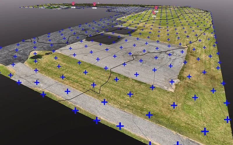
Golf Course Drone Survey – Komoka
276-acre LiDAR and photogrammetry survey for a golf course west of London. Deliverables included contours, classified point cloud, and custom classification to identify hard surfaces, cart paths, parking areas, buildings, and vegetation. Completed in challenging wind conditions.
Drone Solutions for
London Industries
From Western University to automotive manufacturing and agricultural operations, we serve the industries that drive Southwestern Ontario.
Construction & Development
Progress monitoring for residential subdivisions and commercial developments. Orthomosaic mapping for site documentation. Volumetric measurements for earthwork and material tracking.
Industrial & Manufacturing
Roof condition documentation, building envelope thermal scans, and facility documentation for manufacturing plants. Supporting maintenance planning and building condition documentation across London's industrial sector.
Agriculture
Crop health monitoring, drainage documentation, and field mapping for agricultural operations. Supporting precision agriculture across the productive farmland surrounding London.
Commercial Properties
Aerial documentation and inspections for commercial properties. Roof documentation, facade inspections, and site documentation for property management teams.
Drone Services for
London
Comprehensive aerial solutions for every industry and application.
Aerial Mapping & Surveying
High-precision orthomosaics, topographic data, and volumetric measurements.
Learn More →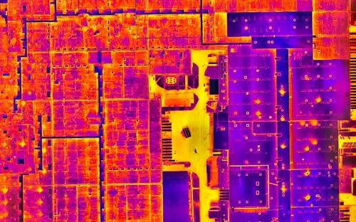
Thermal & Infrared
Certified thermography for roof moisture detection and building envelope documentation.
Learn More →
3D Scanning & Models
Photogrammetry, LiDAR, and digital twins for property documentation.
Learn More →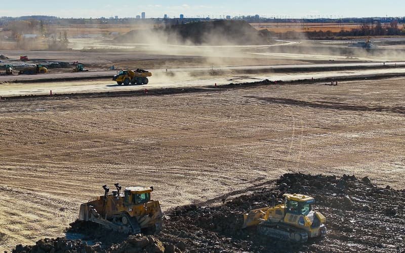
Construction Monitoring
Regular progress documentation and site surveys for development projects.
Learn More →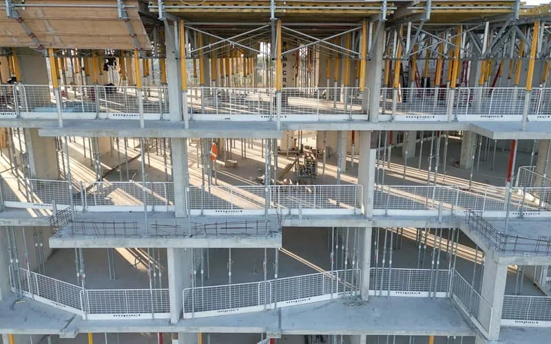
Drone Inspections
Safe, efficient inspections of roofs and facilities without scaffolding.
Learn More →
Aerial Photo & Video
Professional visuals for real estate, marketing, and project documentation.
Learn More →Drone Services in
London FAQs
Do you fly near London International Airport?
Yes. We hold Transport Canada Advanced Operations authorization and coordinate with Nav Canada when working in controlled airspace near YXU. We handle the regulatory requirements so your project proceeds smoothly.
What industries do you serve in London?
We serve construction and development, industrial and manufacturing facilities, commercial properties, golf courses, and agricultural operations across Middlesex, Oxford, and Elgin counties.
How quickly can you mobilize to London?
We serve London on a scheduled basis from our base in Oakville. For time-sensitive projects, we coordinate efficient scheduling to meet your timeline. Contact us to discuss your specific needs.
Do you offer thermal roof inspections?
Yes. We're certified thermographers and conduct infrared roof inspections following ASTM C1153 protocols. We deliver thermal and RGB orthomosaics in formats ready for roofing consultants to analyze.
Let's Elevate Your
London Project
Professional drone services across Southwestern Ontario. Get your free quote today.
Get a Free Quote