
Professional Drone Services in
Niagara Region
Aerial mapping, inspections, thermal imaging, and 3D scanning for wineries, tourism, heritage sites, and industrial facilities across all 12 Niagara municipalities.
Get a Free QuoteServing All 12 Niagara Municipalities
From the urban centres of St. Catharines and Niagara Falls to the wine country of Niagara-on-the-Lake, we provide professional drone services throughout the entire Niagara Region.
Flying drones in Niagara Region requires proper authorization. As Transport Canada certified operators, we handle all regulatory requirements so you don't have to. Have questions? Get in touch →
St. Catharines
Regional Centre
Niagara Falls
City
Welland
City
Fort Erie
Town
Niagara-on-the-Lake
Town
Grimsby
Town
Lincoln
Town
Pelham
Town
Thorold
City
Port Colborne
City
Wainfleet
Township
West Lincoln
Township
Drone Solutions for
Niagara Industries
Specialized aerial services tailored to the unique industries that drive the Niagara Region economy.
Wineries & Vineyards
Aerial mapping for vineyard management, crop health monitoring, marketing photography, and estate documentation across Niagara wine country.
Heritage & Tourism
3D documentation of historic sites, heritage building preservation, and stunning aerial content for Niagara's world-class tourism industry.
Industrial & Manufacturing
Infrastructure inspections, facility monitoring, and thermal imaging along the Welland Canal corridor and industrial zones.
Real Estate & Development
Aerial photography, property marketing, construction progress monitoring, and site surveys for Niagara's growing development market.
Film & Production
Cinematic aerial footage for film, television, and commercial productions taking advantage of Niagara's scenic landscapes.
Agriculture & Land
Precision mapping, crop monitoring, drainage documentation, and land mapping for farms and agricultural operations across the region.
Your Niagara Region
Drone Partner
Regional Knowledge
We understand Niagara's unique landscape, from the Escarpment to the lakeshore, the Welland Canal to wine country. Local expertise means better results.
Fast Response
Based in Oakville, we can deploy to any Niagara location quickly. Same-week scheduling available for time-sensitive projects.
Fully Certified
Transport Canada certified for Complex Operations, Level 2 Thermographer certified, and $6.25M liability coverage for your peace of mind.
Drone Services for
Niagara Region
Comprehensive aerial solutions for every industry and application across the region.
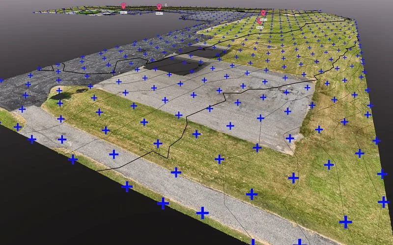
Aerial Mapping & Surveying
High-precision orthomosaics, topographic surveys, and volumetric measurements for construction, agriculture, and land management.
Learn More →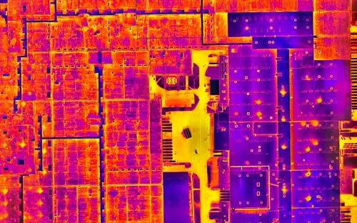
Thermal & Infrared
Certified thermography for roof moisture detection, building envelope documentation, and industrial equipment inspections.
Learn More →
3D Scanning & Models
Photogrammetry, LiDAR, and Gaussian splatting for heritage preservation, building documentation, and virtual tours.
Learn More →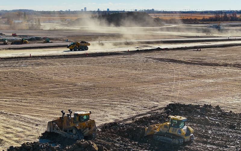
Construction Monitoring
Regular progress documentation, site surveys, and stakeholder reporting for development projects across Niagara.
Learn More →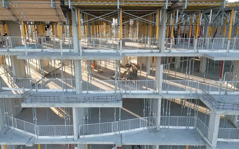
Drone Inspections
Safe, efficient inspections of roofs, facades, infrastructure, and hard-to-reach areas without scaffolding or lifts.
Learn More →
Aerial Photo & Video
Stunning visuals for winery marketing, real estate listings, tourism promotion, and commercial productions.
Learn More →Southern Ontario Coverage
While this page focuses on Niagara Region, we serve clients throughout Southern Ontario. Based in Oakville, we're positioned to respond quickly to projects across the Greater Golden Horseshoe and beyond.
Let's Elevate Your
Niagara Project
Professional drone services across all 12 Niagara municipalities. Get your free quote today.
Get a Free Quote