

LiDAR Mapping Kawartha Lakes
High-precision terrain mapping for cottage builds, waterfront development, and site planning across the Kawartha Lakes region.
Request a Quote →Terrain Data for the Kawartha Lakes
The Kawartha Lakes offer the cottage experience within easy reach of the GTA. This accessibility has driven steady development, from seasonal cottages to year-round homes. Whether you're building new, converting a cottage for four-season use, or planning renovations, accurate terrain data is essential.
Drone LiDAR captures ground elevation through tree cover where aerial photography falls short. Our sensors map the actual terrain beneath the canopy, giving you the topographic foundation for site design, septic planning, and construction.
From Balsam Lake to Pigeon Lake, Sturgeon to Stony, we provide the precision elevation data your project requires.

Full Point Cloud vs Bare Earth
< SLIDE TO COMPARE >

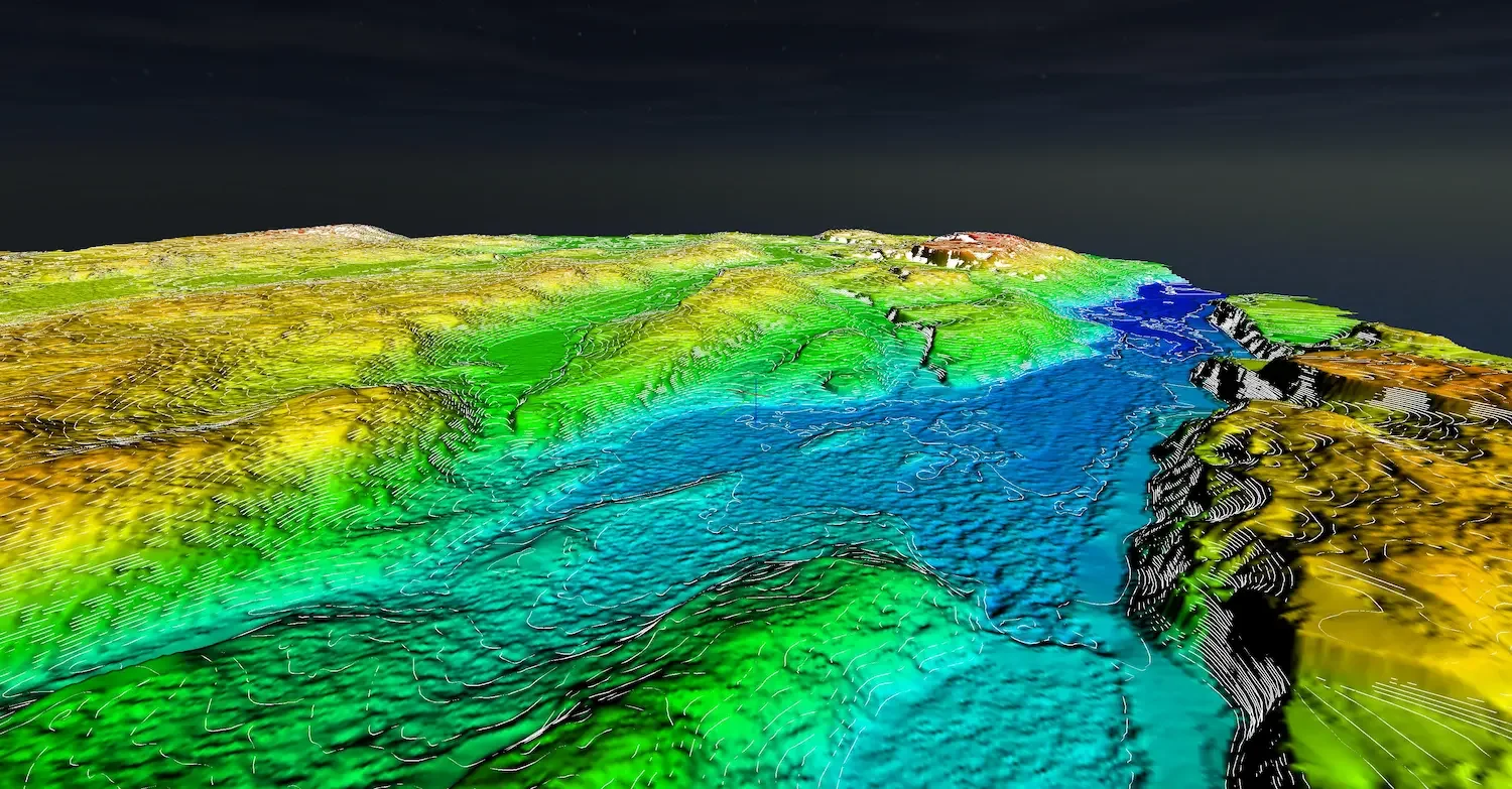
Full classified point cloud with vegetation vs bare earth terrain model showing ground surface.
LiDAR Applications in Kawartha Lakes
Precise terrain data for every stage of your waterfront project
New Construction
Complete topographic data for building placement, foundation design, and grading plans on wooded lots.
Year-Round Conversions
Document existing terrain for cottage upgrades. Essential data for septic upgrades and additions.
Septic System Design
Precise elevation and slope data for septic field layout. Required for health unit applications.
Shoreline Mapping
Document waterfront elevation, bank slopes, and erosion. Baseline data for permits and future comparison.
Drainage Analysis
Model water flow across your site. Identify wet areas, drainage paths, and potential flooding issues.
Driveway Design
Plan access roads with accurate grade profiles. Calculate cut/fill volumes for cost estimation.
Penetrate Dense Canopy
Most Kawartha properties are wooded. Aerial photography only captures the canopy. LiDAR captures what's underneath.
Penetrates Canopy
Laser pulses find gaps in the trees to map actual ground elevation, not just treetops.
2-5cm Vertical Accuracy
Survey-quality precision suitable for engineering design and construction planning.
Complete Site Coverage
Every square meter mapped in a single flight. No gaps or interpolation.
Faster Turnaround
Fly in hours, not days. Processed data delivered within one week.
LiDAR vs Photogrammetry
< SLIDE TO COMPARE >
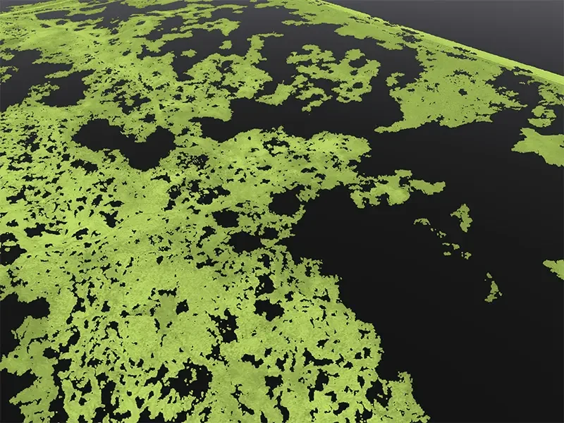
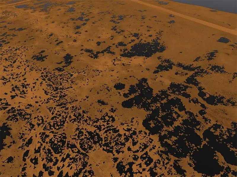
Same forest area: Photogrammetry ground points limited by canopy. LiDAR penetrates to map the ground.
Survey-Quality LiDAR Systems
DJI Zenmuse L3
Up to 350,000 points per second with integrated RTK. Primary sensor for terrain mapping with centimeter-level accuracy.
DJI Matrice 400 RTK
Heavy-lift platform with extended flight time. Covers large properties efficiently in fewer flights.
RTK/PPK Processing
All data georeferenced using NRCAN PPP or local base stations for survey-quality positioning.
Kawartha Lakes Coverage
We serve properties throughout the City of Kawartha Lakes and surrounding areas, from the southern lakes near Bobcaygeon to the northern reaches around Minden.
Also Serving Cottage Country
For remote properties or large sites, contact us to discuss logistics.
Deliverables
Classified Point Cloud
Ground, vegetation, and structures separated. LAS/LAZ format for CAD and GIS.
Digital Terrain Model
Bare earth surface with vegetation removed. GeoTIFF format.
Contour Lines
AutoCAD-ready contours at your specified interval (0.25m, 0.5m, or 1m).
Orthomosaic
High-resolution aerial imagery captured alongside LiDAR data.
LiDAR Mapping Kawartha Lakes
How much does LiDAR mapping cost in Kawartha Lakes?
Pricing depends on site size and location. Contact us with your property details for a specific quote.
Can you survey wooded lots?
Yes, that's where LiDAR excels. Our sensors penetrate tree canopy to map the actual ground surface. In typical Kawartha forest cover, we achieve enough ground returns for accurate terrain modeling.
How accurate is the elevation data?
With RTK/PPK positioning, we achieve 2-5cm vertical accuracy. This meets requirements for engineering design, septic applications, and construction planning.
How long does a survey take?
Flight time varies by property size, but most cottage lots require 30 to 60 minutes of flying. Data processing takes 5 to 7 business days.
What file formats do you provide?
Standard deliverables include LAS/LAZ point clouds, GeoTIFF terrain models, DXF/DWG contour lines, and georeferenced orthomosaic imagery.
Do I need to be on-site?
Not necessarily. We need property access and a safe launch area. We'll coordinate details with you before the flight.
Request Your Kawartha Lakes LiDAR Quote
Accurate terrain data for your waterfront project. Tell us about your property and we'll provide a detailed quote.
Request a Quote →Questions? Reach us at 1-416-797-4870 or info@hollandproductions.ca